Loading Events

BENEFIT TRAIL RIDE
October 3-5, 2025
Near Deerfield, VA

ALL PROCEEDS GO TO BENEFIT RIDE WITH PRIDE

75 RIDER LIMIT PER DAY!!

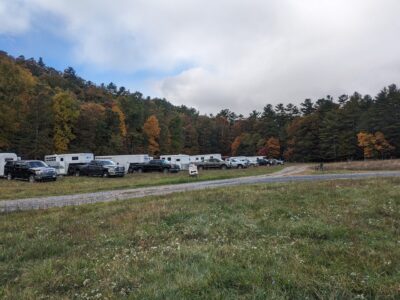
OVERNIGHT CAMPING AVAILABLE!!


 Due to popular demand, we are splitting up the fees for each day’s ride, camping, and food.  This year, you may separately choose which days to ride, choose to have meals, and choose to camp.  Please review the different tickets below and add your choices to your cart.  


Campers may arrive Friday no earlier than 3:00 and must leave Sunday no later than 5:00
There will be water available, but you will need to bring a bucket if you want to take it back to your trailer

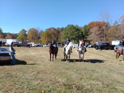
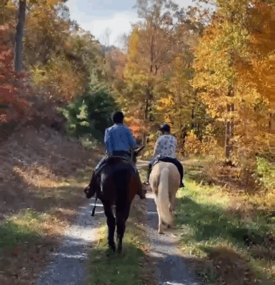
Come enjoy scenic wooded trails at your own pace. All trails will be well marked! 3 trails are available — 5 miles, 8 miles, 10 miles (all approximate) Maps are available for all routes. All will have water crossings! Footing will be mostly forest floor, some forest road, not rocky, but there will be muddy/sloppy spots, depending on weather. 

 
A delicious hot lunch will be available on Saturday and a lite brunch will be available on Sunday. Please feel free to purchase as many of these as you like.
 
Parking is on private land with good solid ground, no matter the weather. Come socialize and enjoy the food, even if you cannot ride!


This is non-refundable as this is a fundraiser, though please feel free to transfer your ticket to someone else if you end up not being able to attend.  If this happens, just let the event organizer (found below) know so we are aware of the change of name.

PLEASE NOTE: it’s best to contact THE EVENT ORGANIZER and NOT the Ride With Pride info email, as that email is NOT the event organizer and it will take longer to get your questions answered!

All fees are for convenient parking access on private land. There is no charge on ride any public National Forest trails, and there is public parking available should you not wish to pay for parking on the large, open private field or join us for lunch.
 
Gates open at 9:00 AM. First riders out at 10:00 AM on both Saturday and Sunday 


PRINTABLE FULL WAIVER 

Please use the printable waiver link to view the complete waiver when signing for the form during online registration, or print it and sign it to bring with you.  Otherwise, you will need to sign a waiver upon arrival at registration!


******There is no cell service at the trail head.*****  

If you need directions or have questions about the venue, please contact the EVENT ORGANIZER using the contact information at the bottom of this page before Friday, October 3rd.  


There will be paper maps available!


 An online interactive map of the trails, can be found here:  https://sartopo.com/m/CSPJ07G

These instructions will apply:

  • RED trails are NOT being used for this ride and are shown for reference only.  They will not have markers!
  • The orange trail is the long loop (approx 10 and a half miles). 
    • Long trail is marked with orange ribbons
  • The blue trail is the medium trail (aprox 8 and a half miles). 
    • Medium Trail is marked with blue polka dot ribbons
  • The pink trail is the short ride (aprox 5 miles).  This route never runs by itself and is designated with pink arrows on this map. 
    • Short Trail is marked with pink ribbons
  • The purple lines are where more than one route run along together. 
  • Online map contains notes about the trails…..if you cannot see the notes, please zoom in on the map


There will be both forest trails and wooded forestry access road riding. The forestry roads are a mix of dirt/shale and light gravel with some sections grassy.

This map is downloadable as a .gpx file so you can add it to your favorite tracking app to follow yourself.  Use the export function at the top left of the trails map page linked above.  You can also download the CalTopo app, (available for Android and iPhones) create a free account, and open the link in the app to follow along as you ride. 

Please note that there will be a section along a forestry road where riders will be both coming and going.  Due to terrain, this is unavoidable.  We will have people stationed there as well as signage.  

PLEASE NOTE THAT TO SEE THE TOPO BACKGROUND MAP WHILE RIDING THESE TRAILS, YOU WILL NEED TO DOWNLOAD THE MAP FILES TO YOUR PHONE AHEAD OF TIME SINCE THERE IS NO DATA SERVICE AT THE VENUE

One final note…..The fees you are paying is for parking on private land and organization and food.  We have cleared and marked routes for your convenience….However, this is public land and it is your right to ride any trails you wish, including the unmarked trails.  If you do so, know that you ride at your own risk, as you would with any place you would go on your own.  There is also public parking available further in the National Forest if you do not wish to use our trailhead.

Please use the GPS point provided below; the house address is not available publicly due to privacy concerns. This GPS point will take you directly to the event location.

Please click on the “view larger map” link on the map below for a larger view and to “get directions” to your mobile device. The parking, camping and trail head will be at the waymark point.

Tickets

The numbers below include tickets for this event already in your cart. Clicking "Get Tickets" will allow you to edit any existing attendee information as well as change ticket quantities.
Tickets are no longer available

Please choose from the options on the left to customize your weekend ride!